01 / 06
Wildfire
Real-time fire detection, perimeter mapping, hotspot tracking across the whole contracted fleet.
Voxelis equips aircraft with the sensing, compute, and connectivity to operate alongside the crew, turning every flight hour into multi-mission intelligence at fleet scale.
Millions of flight hours are flown each year across critical missions, wildfire response, search and rescue, infrastructure inspection, and ISR. Every aircraft is limited to the workload of the crew onboard. One mission at a time.
Voxelis equips every airframe with the sensing, compute, and connectivity to operate beyond that limit. Multiple missions in parallel. Real-time intelligence delivered without additional crew, on the aircraft already flying.
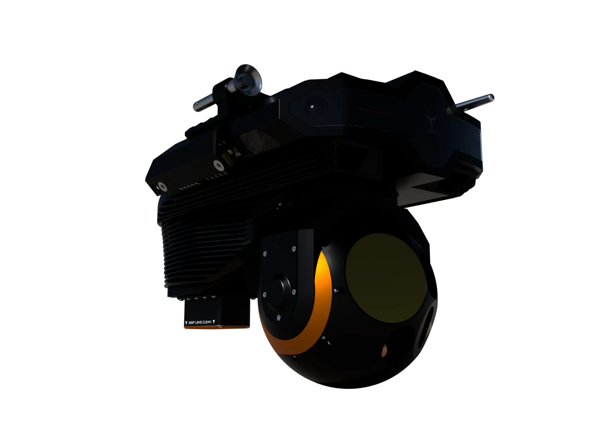
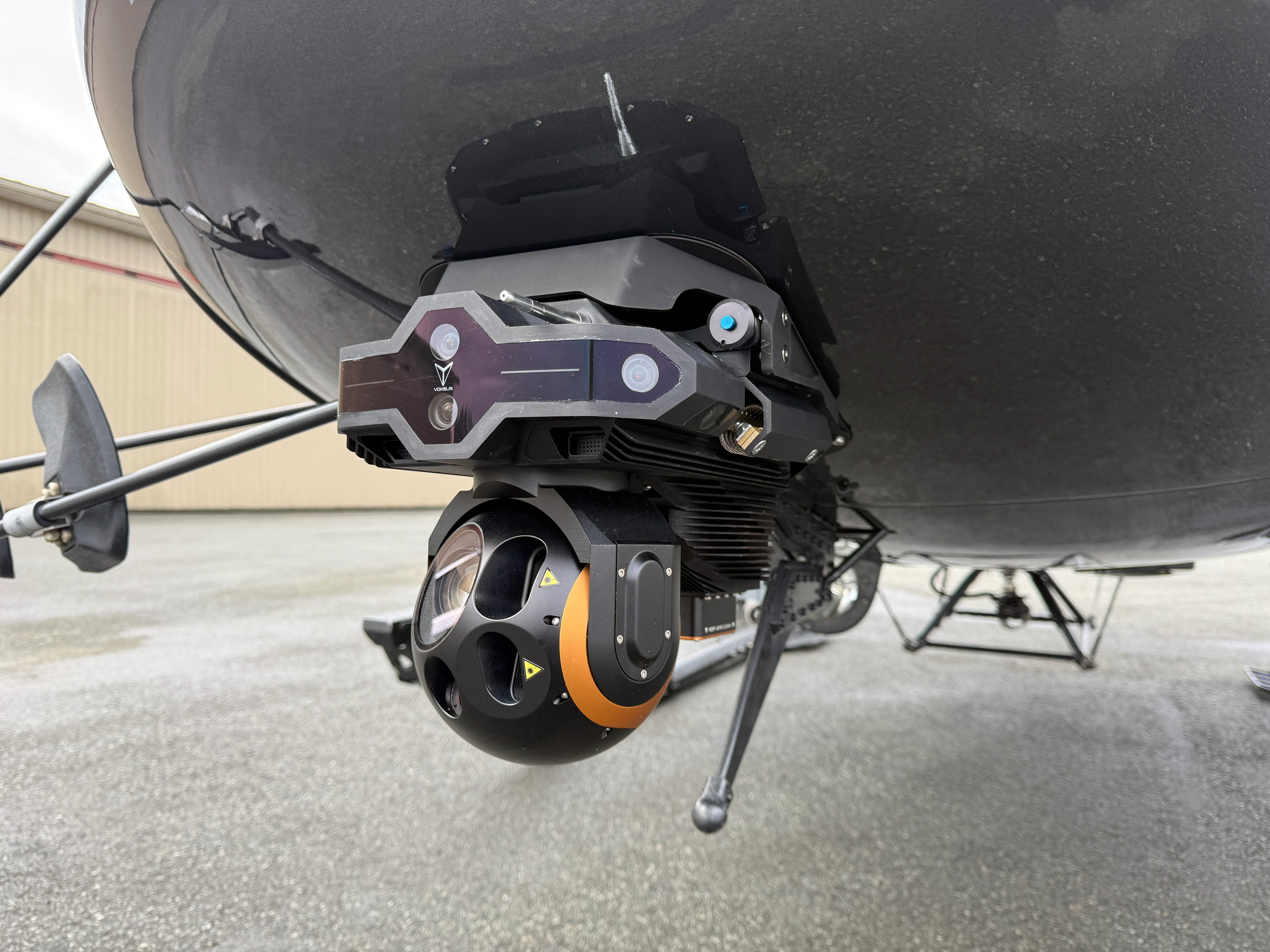
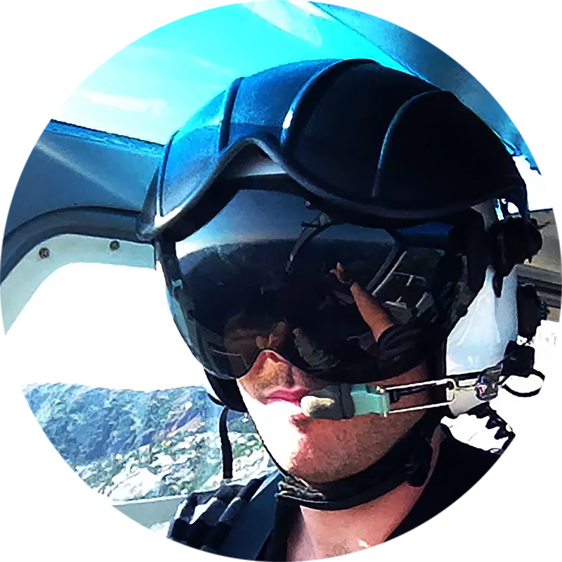
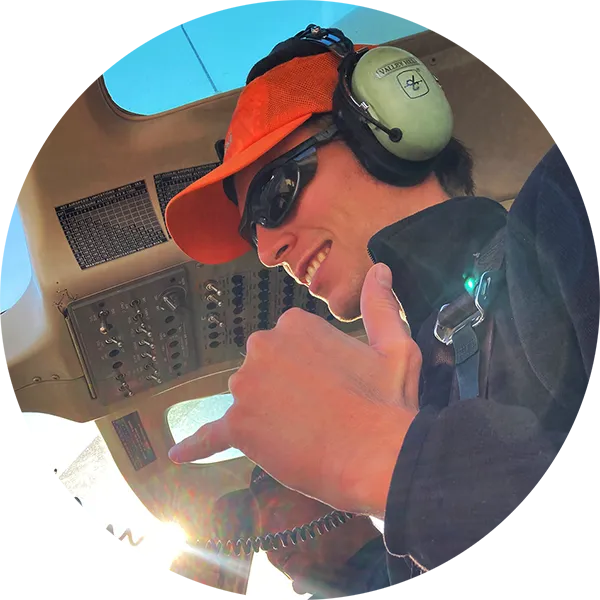
VoxVision turns any compatible aircraft into a multi-mission intelligence node. Seven sensor systems, dual NVIDIA edge AI, and more onboard compute than anything designed for mass airborne deployment, in a 7 kg payload that mounts in under 30 seconds and is operated from an iPad.
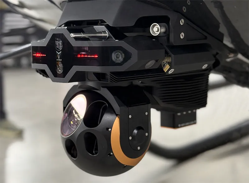
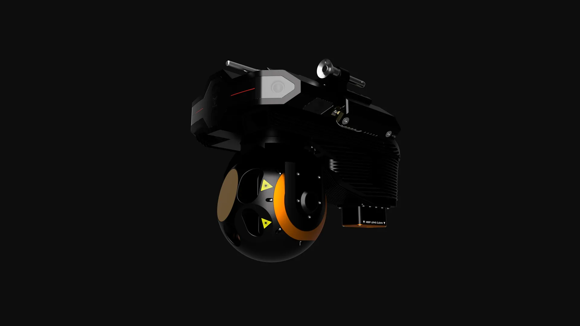
Existing airborne sensors were designed for a handful of dedicated platforms. VoxVision was designed from day one for fleet-wide deployment on the aircraft already flying.
| Typical airborne sensors | VoxVision | |
|---|---|---|
| Cost per unit | Typical $1M+ for purpose-built systems | VoxVision ≈ one-tenth the cost |
| Install time | Typical Specialized technician, hours of downtime | VoxVision Pilot, under 30 seconds |
| System weight | Typical 50+ lbs, often more | VoxVision ≈15 lbs total |
| Operation | Typical Dedicated sensor operator every flight | VoxVision Pilot via tablet, no extra crew |
| Data delivery | Typical Post-flight, hours after landing | VoxVision Real-time, in flight |
| Onboard compute | Typical None, post-flight transfer to ground | VoxVision 315 TOPS · Dual NVIDIA Orin |
| Software updates | Typical Hardware refresh cycles | VoxVision OTA, fleet-wide |
Comparison frame: purpose-built airborne EO/IR systems in the same role class.
Real-time intelligence where you already work. VoxNet streams live data, EO/IR imagery, on-demand mapping surveys, and updating GIS layers from every Voxelis-equipped aircraft straight into the agency stack, securely stored, tagged to the operator and the end user.
Detections, perimeter changes, and atmospheric data update on the GIS layer while the aircraft is still on station, no post-flight downloads.
Georeferenced output integrates directly with the GIS platforms your analysts already use. Standards-based, drop-in.
New detection models and mission profiles ship over the air to every equipped aircraft at once. Capability arrives in the air.

The same payload and platform serve every mission. Profiles change in software, not hardware, so a single retrofit unlocks every category below.
Real-time fire detection, perimeter mapping, hotspot tracking across the whole contracted fleet.
AI-assisted detection of persons and objects in complex terrain. Broader coverage from every aircraft on scene.
Powerline, pipeline, and corridor inspection. Automated anomaly detection from routine overflights.
Crop health, irrigation assessment, and yield prediction from fleet-equipped agricultural aviation.
Coastal surveillance, vessel tracking, and environmental monitoring from offshore aviation.
Tactical situational awareness and persistent surveillance, deployable on existing government fleets.
Wildfire is where Voxelis is operationally first. The need is most acute, the contracted fleet is the largest, and BC is where we test against the hardest version of the problem.
An aircraft dropping water on a fire can now return real-time intelligence (fire behavior, weather, assets at risk, spread potential) back to the agency mission managers running the response.
The same flight that drops retardant becomes a continuous mapping pass. Hotspot detection, perimeter changes, and infrastructure exposure update on the GIS layer while the aircraft is still on station.
Onboard detection from EO/IR + thermal, fused with environmental sensors.
24.5MP nadir surveys deliver drone-quality maps from manned aircraft.
VoxNet pushes detections and updates straight into the agency's GIS stack.


Two arcs the platform is built for. Both running today. Both compounding with every install.
Wildfire response, emergency and disaster management, environmental research and compliance, and other industrial support activities. Every one of those missions already flies on civil airframes, every day, in airspace government fleets can't blanket alone.
Equipped with VoxVision and connected through VoxNet, those civil fleets become national capability. Sovereign and agency-grade intelligence, contributed by the aircraft already on contract or performing other missions.
Onboard AI today watches sensors so pilots don't have to. The next layer is airborne agents working alongside the crew. Sensor steering, detection triage, mission reporting, in-flight decision support. Taking the repetitive load so humans focus on judgment and command.
Every flight hour is training data on how the hardest missions are flown by the best pilots. The result is safer missions, more effective missions, and a system that gets sharper with every release.
Mechanical, embedded, computer vision, and geospatial, under one roof in Vancouver, flying our own hardware in the airspace we engineer for.


Operators retrofitting the fleet, agencies tapping the intelligence stream. Either path, reply within 1 business day.